Woolsey Fire
Fire Status and Investigation
The Woolsey Fire erupted at approximately 2:24 p.m., on November 8, 2018, near the intersection of E. Street and Alfa Road near the Santa Susana Field Laboratory (Rocketdyne Facility) in Simi Valley, Calif. The fire is burning to the west, from the Rocketdyne Facility towards Ventura County Fire Department Station 36. The Ventura County Fire Department reports that the fire is 0 percent contained despite having more than 400 firefighters battling the blaze. It is expected that the fire will burn to the coast, like the 2017 Thomas Wildfire. The image below was captured on the first night of the fire as it came over a ridgeline.
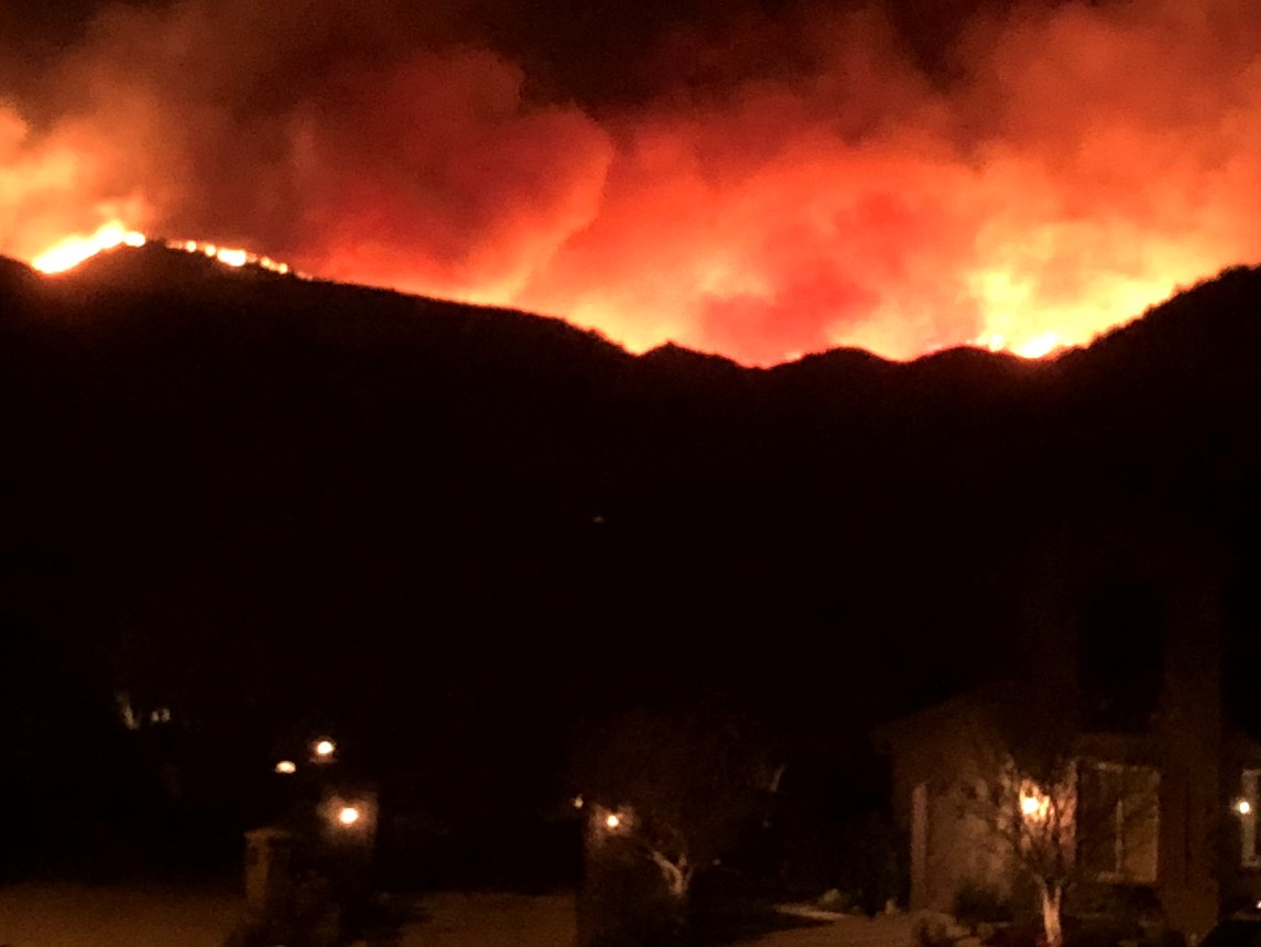
Photo courtesy of Howard Maycon
The fast-moving fire is being driven by Santa Ana winds and quickly burned over 10,000 acres and an unknown number of homes and structures. More than 75,000 homes are under mandatory evacuation. The fire is still growing and is threatening homes throughout Ventura County as it makes its way towards Malibu and the coastline. Affected ZIP Codes include 93065, 91377, 91302, 91301, 91361, 91362, 90265, 91320 and 91372.
The heavily traveled 101 freeway that stretches across the valley and numerous surface streets in the area have been closed.
Santa Ana winds are expected to blow continuously through Friday morning and the next 48 hours will be critical to the firefighting efforts. When the fire will be contained is unknown. Firefighting crews are also fighting the Hill Fire, which burned more than 8000 acres overnight in Ventura County, in Santa Rosa Valley. (More on the Hill Fire below.).
The cause of the Woolsey Fire is not yet known and is under investigation. Consultants with expertise in wildfire investigation are retained and have been dispatched to the fire scene.
The general area of the Woolsey Fire is depicted on the far right and the Hill Fire on the left of the image below.
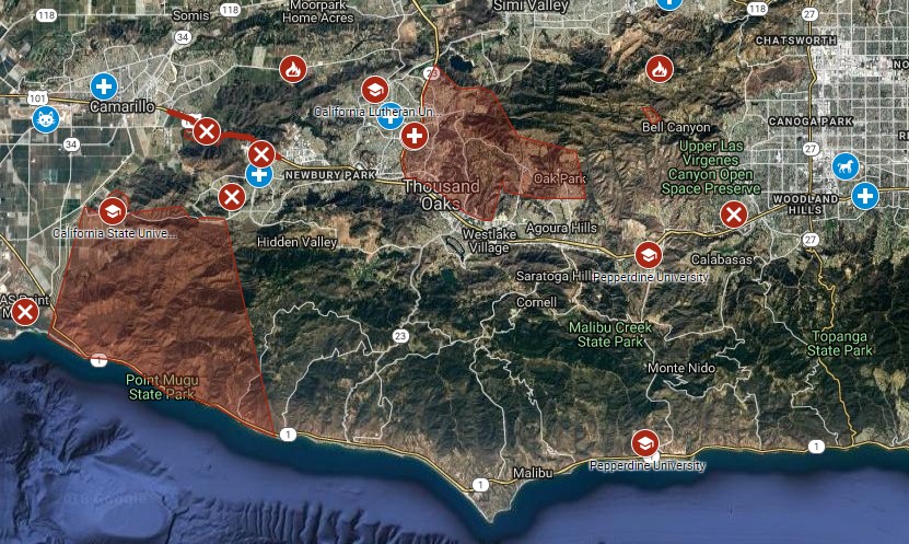
Image courtesy of the Ventura County Fire Department
Hill Fire
Fire Status and Investigation
The Hill Fire erupted at 2:03 p.m. PST in Newbury Park at the intersection of Hill Canyon Road and Santa Rosa Road. Powerful winds pushed the fire through the canyons to the edge of Camarillo Springs and the campus of California University Channel Islands.
Ventura County Fire Captain Brian McGrath reported that the fire is following the path of the Spring Fire that occurred three years ago. Captain McGrath also reported that the 30 to 40 mph winds are prohibiting their ability to attack the fire. The Hill Fire closed portions of Route 23 and the 101 freeway in both directions at Camarillo Springs Road.
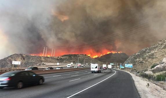
Image courtesy of the Ventura County Fire Department
The fire is still growing and is threatening 3,500-5,000 homes throughout Ventura County as it makes its way towards Malibu and the coastline. Affected ZIP Codes include 93012, 91319, 91320, 91360, 91361, 91362, 91358, 91359 and 93010.
The cause of the Hill Fire is not yet known and is under investigation. Consultants with expertise in wildfire investigation are retained and have been dispatched to the fire scene.
Camp Fire
Fire Status and Investigation
The Camp Fire erupted on November 8, 2018, at 6:30 a.m. in the area of Camp Creek Road and Pulga Road near Feather River Canyon in Pulga, Calif. The fire rapidly spread west toward Paradise, Calif. To date, the Camp Fire has consumed over 70,000 acres and is 0 percent contained. Cal Fire has not been able to conduct a survey of the number of homes destroyed but reports that it may be more than 1,000 homes damaged or destroyed. In addition, a number of commercial structures including restaurants, a hospital, school, and other commercial buildings have been damaged. Firefighting efforts have been hindered by fast-moving winds as the fire grew at a rate of 80 football fields per minute.
There is a mandatory evacuation in place impacting the entire City of Paradise and its 26,000 residents.
Zip codes immediately affected by this fire include 95969, 95965, 95954, 95928, and 95942.
Cozen O’Connor has already retained investigators who are working to get access to the origin area. We expect to have an update soon on the potential cause. Below are select photographs and maps for illustration.
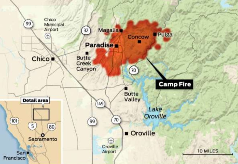
Image courtesy of NASA MODIS

Photo courtesy of Twitter
Purported Area of Fire Origin
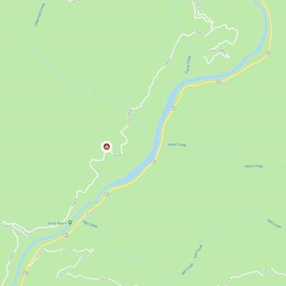
Image courtesy of CalFire